Revised on: Nov. 21, 2023 - 1:22 p.m.
EPA#: AZ0000309013
Superfund National Priority List (NPL) Placement: Sept. 3, 2008
Location
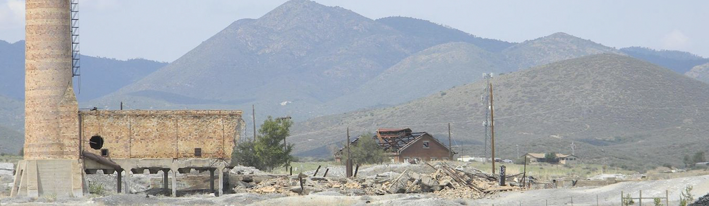
The former Iron King Mine and Humboldt Smelter are located in the town of Dewey-Humboldt, Yavapai County, Arizona.
Bordered by Chaparral Gulch to the north and Galena Gulch to the south, the former Iron King Mine encompasses approximately 153 acres west of State Route 69. The former Humboldt Smelter area occupies approximately 182 acres east of State Route 69 including an area along Chaparral Gulch and the property at the east end of Main Street in the town of Dewey-Humboldt | View Site Map >
Contaminants of Concern
Soil | Arsenic, Lead, and other heavy metals
Groundwater | Arsenic, lead, and other heavy metals
- We encourage you to test the well water if you have a private well near the exceedance.
- Not sure what to test for? | Learn More >
COCs at the site may change as new data become available.
Action Taken
In 2008, the United States Environmental Protection Agency (EPA) initiated a remedial investigation (RI) with the primary objectives of determining the nature and extent of contamination and gathering information to select a remedy that eliminates, reduces or controls risks to public health. The EPA collected soil, sediment, surface water, groundwater and air samples from the Iron King Mine, Humboldt Smelter, residential and commercial areas, and waterways (Chaparral Gulch, Galena Gulch and Agua Fria River). The results from the RI indicated a need for cleanup actions to protect public health and the environment.
Between 2011 and 2012, the EPA completed a removal action that included cleanup of a subset of residential yards, removal of the Iron King Mine small tailings pile adjacent to the Chaparral Gulch and application of a soil sealant to the Humboldt Smelter dross piles. The EPA also evaluated background levels of arsenic and lead in the area and continues to evaluate groundwater at the site.
Between 2013 and 2014, the EPA continued investigations on and near the mine and smelter, and within residential yards to better understand contamination at the source areas.
Between April and July in 2017 the EPA cleaned up surface soils in 31 residential yards in Dewey-Humboldt that had soils contaminated with lead and/or arsenic from the former mine and smelter activities after investigating, sampling and evaluating over 600 properties. For further information please refer to EPA's fact sheet dated August 2017 | View/Download Fact Sheet >
Between November 2021 and June 2022, ADEQ conducted a project, in coordination with the EPA, to take down the Humboldt Smelter Stack, install fencing on the Humboldt Smelter area, and mitigate dust by application of soil sealant to the Humboldt Smelter dross.
ADEQ in March 2023 began conducting a project on behalf of EPA, to collect data which will be utilized in developing the Remedial Design Report.
Status
The EPA has completed the Record of Decision dated Oct. 20, 2023, that presents the cleanup method selection and the remedial action which EPA will conduct. The EPA is currently working on the Remedial Design which will document how the cleanup will be conducted to meet the cleanup standards outlined in the Record of Decision | View/Download ROD >
EPA is planning to conduct soil sampling at residential properties within the Superfund site. EPA will be seeking access via signed Access Agreements to these properties. Samples will be analyzed for the presence of lead, arsenic and other metals. EPA has compiled a list of Frequently Asked Questions regarding the Access Agreements which can be viewed here | View/Download Access FAQ >